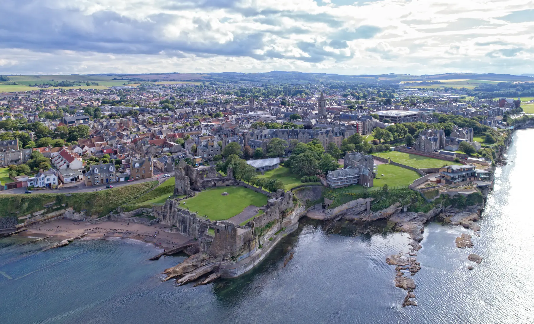
St Andrews sits on a headland between two beaches with a ruined cathedral at one end and the oldest golf course in the world at the other. The Fife Coastal Path runs straight through it — 187 kilometres from the Forth to the Tay — and the sections either side of the town are among the best on the route.
Inland, Fife is farmland rather than mountain: gentle, hedged, and threaded with burns and small woods. The walking here is coastal or it is pastoral, and it is almost all easy.
Distances are from the town centre.
Three kilometres of flat sand running north-west from the Old Course, backed by dunes and links. It is one of the great British beaches — wide enough that it never feels busy, firm enough to walk or cycle on, and the setting for the opening sequence of Chariots of Fire, which is filmed here and is why a certain number of visitors run along it self-consciously.
Walking the full length and back takes about an hour and a half, entirely level, with the town and the cathedral behind you the whole way.
A smaller, more sheltered beach on the other side of the harbour, below the cathedral. There is a leisure centre, a café and a sailing club, and it is the start of the Fife Coastal Path heading south.
A tiny cove directly below the castle, with a natural rock pool cut into the shelf. Generations of students have swum in it, most famously in the May Dip — the tradition of running into the North Sea at dawn on the first of May, which is either a purification ritual or an excuse depending on who you ask.
St Andrews is small and its plan is medieval: three parallel streets — North Street, Market Street and South Street — running from the West Port gate down to the cathedral, with narrow wynds linking them.
A walk from the West Port along South Street, past Blackfriars Chapel and St Mary’s Quad, to the cathedral and St Rule’s Tower, then round to the castle and back along The Scores with the sea below, takes about ninety minutes and is the best introduction to the town. It is free, and everything on it is worth stopping at.
The Scores — the clifftop road between the castle and the golf links — has the Martyrs’ Monument and the university buildings along it, and the best views back over the town.
From East Sands the path runs south along low cliffs past Kinkell Ness, the Rock and Spindle — a sea stack of volcanic rock that looks like exactly what its name says — Buddo Rock and Kingsbarns, to Crail, thirteen kilometres away.
It is one of the finest sections of the whole path: cliffs, caves, arches, rock platforms and almost no development. Crail has a bus back.
Beyond Crail the East Neuk villages — Anstruther, Pittenweem, St Monans, Elie — follow one after another, each with a harbour, and the path links them all.
From West Sands the path runs to the mouth of the Eden estuary, round the Eden Estuary Nature Reserve — one of the best bird sites in eastern Scotland, with large numbers of waders and wildfowl — and on through Tentsmuir Forest to Tentsmuir Point, a national nature reserve of dunes and pine forest with seals hauled out on the sands in large numbers.
It is about ten kilometres to Tentsmuir and the seal colony there is one of the more impressive free wildlife sights in Scotland.
Four kilometres south-west, and a proper Edwardian estate park: a boating lake with an island, the Dutch Village, a miniature railway, glasshouses, formal gardens and woodland walks. Free to walk in; the attractions charge. See our Craigtoun page.
A kilometre from the centre, on the banks of the wooded Kinness Burn in the Canongate. Eighteen acres of glasshouses, a rock garden, a peat garden and woodland, and one of the quietest places in the town. See our Botanic Garden page.
The stream that runs through the southern side of the town, with a path along it from the Botanic Garden into the centre — shaded, level and almost entirely used by locals.
Seven kilometres south, a small wooded glen beside a churchyard with carved rock, a well and a Celtic head cut into the stone. It has become a place where people leave offerings on the trees, and it is either atmospheric or slightly unnerving depending on the light.
Getting to the trailheads. Buses run down the coast to Crail and the East Neuk and inland to Cupar and Dundee. Leuchars station, ten kilometres west, is the railhead, with buses connecting.
The coastal path is well waymarked but is cliff-top in places with steep steps into and out of the gullies. It is muddier than it looks after rain.
Tides matter at the Rock and Spindle and on the sections below the cliffs.
The Old Course is public common land and there are rights of way across it — the Sunday walk across the links is a St Andrews institution, because the Old Course is closed to golf on Sundays. Stay off the greens and give way to nobody, since nobody is playing.
Wind. This is the east coast and it is exposed. West Sands in a north-easterly is character-building.
Spring brings the wildflowers to the links and the dunes, and the coastal path south is at its best before the summer growth. It is also when the East Neuk is quietest.
Summer is long-lit — this far north the evenings run to eleven in June — and West Sands at nine in the evening is one of the pleasures of a St Andrews summer. The town empties of students and fills with golfers.
Autumn brings the Dunhill Links in October and the best light of the year, with the coast path clear and the seals pupping at Tentsmuir.
Winter is cold, bright and windy, and the beaches are magnificent and empty. The links stay open — they drain almost instantly — and the town belongs to its residents and students again.
This is the east coast of Scotland, and the wind is the defining feature of walking here. A north-easterly straight off the North Sea will cut through anything and there is no shelter at all on West Sands, on the links or on the cliff path.
The practical consequences: bring more layers than the temperature suggests, choose the sheltered side of the town when it is blowing hard, and take the inland walks — the Lade Braes, the Botanic Garden, Craigtoun — as the alternative rather than the consolation. They are genuinely good, and on a bad day they are the difference between a walk and an ordeal.
West Sands for the beach; East Sands south to the Rock and Spindle for the cliffs; the town’s three streets for the history.
Yes — it is public common land with rights of way, and it is closed to golf on Sundays, when walking across it is a local tradition.
About 187 kilometres from Kincardine on the Forth to Newburgh on the Tay, passing through St Andrews roughly in the middle.
Tentsmuir Point, ten kilometres north across the Eden estuary, where large numbers haul out on the sands.
West Sands, the Kinness Burn path and the Craigtoun grounds are all level.