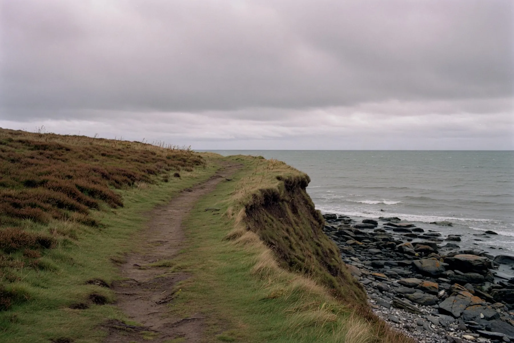
The Fife Coastal Path does not skirt St Andrews. It comes in along East Sands, crosses the harbour, runs the cliff past the castle and the first tee, and leaves again toward the Eden. Fife Coast and Countryside Trust, who look after the route, put the whole trail at around 117 miles, 188 kilometres, from Kincardine on the Forth to Newburgh on the Tay. The useful fact for a stay here is simpler: the town sits in the middle of their Cambo Sands to Leuchars stage, and the two directions from the harbour are not the same walk.
Walk south if you want cliffs, rock stacks and a bus home from Crail or Kingsbarns. Walk north if you want sand, a cycle path and Leuchars station. Do the south only on a falling tide. The Trust’s Cambo Sands to Leuchars page is the document to read the night before; Traveline Scotland and Stagecoach are the documents for the ride back. Our walks page is the wider map. This one is the path itself.
East Sands is where the southbound path actually starts: a curve of sand below the cathedral, leisure centre on the shore, harbour on the left. The Trust lists toilets, a café, parking, a play area and seasonal RNLI cover. The beach holds a 2026 Keep Scotland Beautiful Beach Award. The sand itself moves; do not expect last year’s profile.
From the harbour lock you are on a tarmac front path, then climbing. St Andrews Pier is the breakwater you have just left, not a detour unless you want twenty minutes over water. The coast path is already heading for the braes.
Kinkell Ness is the first named rise. Heading south you climb off the beach onto the clifftop beside St Andrews Holiday Park, which sits on the braes at KY16 8PX with the path along its seaward edge. It is about a kilometre from East Sands in a straight line; the steps and the park boundary make it feel longer.
Stagecoach’s 95 and X61 both stop on the A917 at Kinkell Braes Caravan Park — the old name still on the stop. That is the abort if the wind has got up or you only wanted the view back over the bay. It is not a substitute for reading the tide.
The Trust is blunt: Boarhills to St Andrews “should be walked only at low tide”, and it “may be the roughest of the whole route”. Walkhighlands puts the tidal pinch near Buddo Rock, roughly two-thirds of the way along their Kingsbarns to St Andrews stage, and warns that part of the path before Boarhills has fallen into the sea. If the tide is out you can use the shore. If it is in, you wait. Do not climb fences. The Trust’s stay-safe page says some sections are impassable at high tide twice a day. Check tide times and Forth Ports before you leave the harbour, and again if you are starting from Crail.
Buddo Rock is a pink sandstone stack. Further on, the Rock and Spindle is what is left of a volcanic plug; Walkhighlands describes a cut step and a metal foothold on the way to it. After rain, and in winter when cattle are on the ground, the same miles are mud. Warning signs are in place on the eroded Kingsbarns Beach to Boarhills ground. Read them. Check the red bar on the Trust site for route changes on the day.
Cliffs slump. Stay back from the edge, and do not walk the foot of a crumbling face. That is the Trust, not atmosphere.
Walkhighlands times Kingsbarns to St Andrews at 13.5 kilometres, three to four hours, and Crail to Kingsbarns at 9.5 kilometres, three to three and a half. Together that is 23 kilometres of coast. From Crail the path rounds Fife Ness, through the Scottish Wildlife Trust’s Kilminning Coast reserve, and along shore that is again tidal under the Randerston cliffs — wait for low water, the Trust says. Livestock graze. Keep a dog close.
Kingsbarns has a charged shore car park, toilets and, in season, a kiosk. Give way on the golf-course edge. 1–4 October 2026 the Alfred Dunhill Links Championship plays Kingsbarns, Carnoustie and the Old Course. Thursday to Saturday spectator entry is free; Sunday 4 October is ticketed. Check the organiser before you treat those fairways as a footpath.
Crail is the harbour you are walking toward, and the bus you want. Stagecoach 95 runs St Andrews bus station, Kingsbarns (The Square), Crail, Cellardyke, Anstruther and Leven. Frequencies move; Fife changes from 17 August 2026 were still flagged on the live 95 page this week. Look up the day you walk on Stagecoach. Our day trips page is the villages. This page is only saying you can walk one way and ride the other.
The other way is a different path. From Golf Place the waymarkers take you along The Links, behind the Old Course Hotel, then onto the cycle path beside the A91 toward Guardbridge. Welcome to Fife lists East Sands to Leuchars among the more accessible stretches: built-up ground and a cycleway, not the red-grade rocks to the south. Surfaces still puddle. It is not a promenade.
You pass the golf end of town, not the beach. West Sands runs on your right if you detour; the official path is inland of the hotel. The Old Course is public common on Sunday. Stay off the greens either day.
Guardbridge is the lowest bridging point on the River Eden. The Trust dates the crossing to 1419. A spur goes to Coble Shore for the Eden Estuary Nature Reserve — a local nature reserve that is also an SSSI, a Special Protection Area and a Ramsar site. The small visitor centre at Guardbridge opens seven days, 9am–5pm April to October and 9am–4pm November to March; you need an access code from the conservation officer or from Harbourmaster’s House on 01592 656080. Capacity is about ten. Black-tailed godwit, grey plover, redshank, shelduck. Common seals. The 99 stops in the village.
Leuchars is the railhead. Stagecoach 99 is the Dundee–Leuchars–St Andrews corridor, at least every ten minutes in the daytime on Stagecoach’s own Dundee page, thinner later. Confirm. Our car-free guide is the station-to-bus-station hop.
Do not add Tentsmuir National Nature Reserve as if it were the next bay. It sits on the Trust’s Leuchars to Wormit Bay stage: 16 miles, six to seven hours for the whole stage. NatureScot manages the reserve with Forestry and Land Scotland. From Kinshaldy car park it is about 2.5 kilometres to the edge of the reserve at Tentsmuir Point; from Tayport village about 3 kilometres. Leuchars station is 5 kilometres from Kinshaldy.
Seals haul out year-round. Grey seals pup in autumn; Walkhighlands notes pups on the sand often from October to December. Stay on the path and give them room. Kinshaldy toilets follow car-park hours, usually 9am to sunset. Stagecoach 42 serves the Tayport entrance. NatureScot’s visiting page listed it every 30 minutes; check Stagecoach on the day.
South of town: unsurfaced, steps, rock, mud, tide. North of town: cycleway, pavement, then boardwalks and forest track once you are into Tentsmuir. The Trust’s map, sold from their shop, colour-codes green, blue and red. Red is the remote and tidal ground.
The east coast takes a north-easterly without shelter. Haar can drop visibility on the cliffs even in summer. Layers, a hat that stays on, and a plan to turn round.
FCCT toilets sit at East Sands, both West Sands blocks, Kingsbarns and Crail Roome Bay. Hours are seasonal and weather can keep a block shut; the disabled cubicle at East Sands is listed as open all year with a RADAR key. Read the current sheet on the Trust’s travel page.
St Andrews Castle is on the cliff line through town. Historic Environment Scotland open daily in season, 9.30am to 5.30pm until 30 September, then 10am to 4pm; last entry 45 minutes before close. The mine, countermine and Bishop’s Apartments were closed as of early September 2026. St Andrews Cathedral grounds are free; the museum and shop were closed for conservation, with parts of the graveyard fenced. Check HES, not a screenshot.
The Trust’s Cambo Sands to Leuchars page, and the red message bar. Tide tables. Stagecoach 95 if you are going south, 99 if you are going to the station. If you are here in the last days of Fife Outdoor Activities Week (5–13 September 2026), Welcome to Fife still has walk listings — confirm they have not ended. If you are here for the Dunhill, the path is still a path, but Kingsbarns and the Old Course are an event. When to visit is the calendar. This page is the coast.